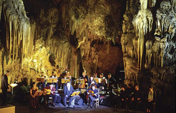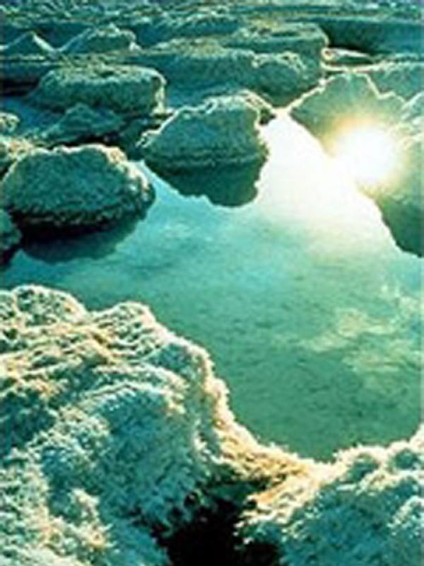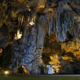
La Cueva de Nerja es un yacimiento arqueológico natural de formaciones karsticas donde se alza la columna más gruesa del mundo formada por la fusión de una estalactita y una estalagmita, Record Guiness en 1989.
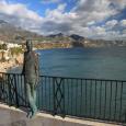
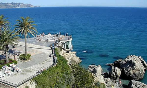
El Balcón de Europa se encuentra situado sobre el acantilado que separa las playas del Salón y Calahonda, donde estuvo situado el Castillo Bajo de Nerja, construido a comienzos del siglo XVI. Dicho castillo fue remodelado en el siglo XVIII para dotarlo de una batería para cañones.
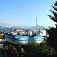
El barco de Chanquete “La Dorada” es quizás el símbolo del pleno desarrollo turístico de Nerja. Es la gran protagonista del feliz canto, que el cineasta Antonio Mercero realizó a Nerja al comienzo de la década de los 80 del pasado siglo XX, a través de la serie de Televisión Española “Verano Azul”.
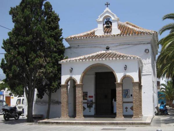
La ermita de Nuestra Señora de las Angustias de estilo Barroco, fue fundada en 1720 por doña Bernarda María Alférez, miembro de la familia granadina de los López de Alcántara y también propietaria del ingenio azucarero “San Antonio Abad”. Con las rentas del ingenio azucarero se sufragaron los gastos de edificación y mantenimiento de la ermita.
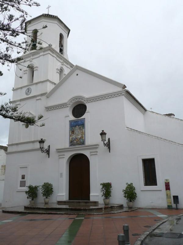
La iglesia de El Salvador se terminó de construir en 1697, edificándose su campanario en 1724. Fue ampliada a finales del siglo XVIII, siendo restaurada en su aspecto actual en 1997.
La fuente de Europa es el símbolo permanente y motivador de la vocación europeísta de la Villa de Nerja, pueblo del Balcón de Europa en el momento de la integración de España en la entonces C.E.E., hoy Unión Europea.
La fuente Cantarero fue construida a principios del siglo XX, promovida por Don Francisco Cantarero siendo alcalde de Nerja, en relación con el primer abastecimiento de agua potable en el casco urbano.
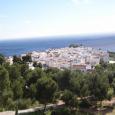
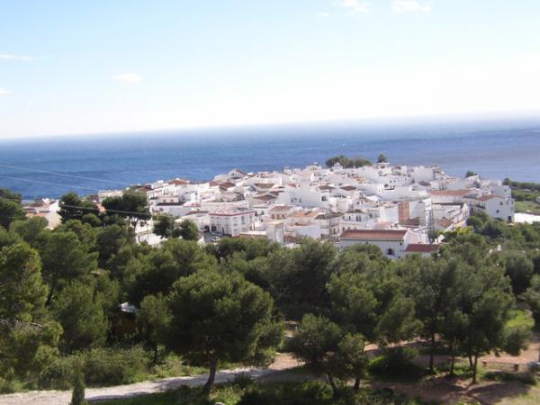
Maro es un hermoso y blanco pueblo que está situado sobre los acantilados de la bahía de Nerja, entre la Caleta y el Barranco de Maro; entre el Balcón de Europa y Cerro-Gordo.
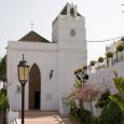
La iglesia de Nuestra Señora de las Maravillas, se tienen noticias de que se terminó a finales del S. XVII, aunque sus características arquitectónicas sugieren que pudo reutilizarse una estructura previa o bien que su conclusión se llevó a cabo siglos después de ser diseñada.
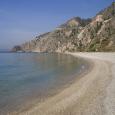
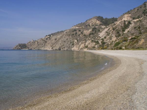
Los Acantilados de Maro-Cerro Gordo aparecen donde la Sierra Almijara hunde sus pies en el Mediterráneo.
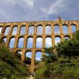
El acueducto del Águila fue construido a finales del siglo XIX “a la manera de los acueductos romanos” y se creó para el regadío y para llevar agua a la antigua fábrica de azúcar “Las Mercedes” o “San Joaquín”. Al igual que esta última, su construcción se debe al maestro local D. Francisco Cantarero padre, cuya firma se conserva aún grabada junto al templete central.
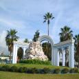
El Rapto de Europa es el monumento erigido por el pueblo de Nerja el 26 de Enero de 1986, con motivo de la adhesión de España a la Comunidad Económica Europea (Unión Europea).
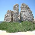
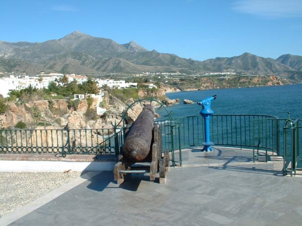
El emplazamiento de La torrecilla se cree que su primera utilización estuviera relacionada con la línea de vigilancia costera diseñada por los nazaríes durante el siglo XIII. Sin embargo, los restos que aún nos quedan de esta torre corresponden a un edificio posterior, levantando en el siglo XVIII para hacer frente a las incursiones de los piratas berberiscos.
La playa La Torrecilla recibe el nombre de la torre pequeña, antigua torre vigía, que encontramos en el lado oeste de la playa. Es distinguida cada año con la Bandera Azul de la UE y La Q de Calidad Turística en Playas.
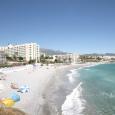
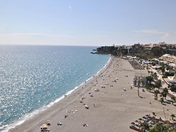
La playa de Burriana es la playa más famosa de toda la costa nerjeña, bien por sus maravillosas vistas al comienzo de los acantilados o por que fue escenario de la famosa serie “Verano Azul”.
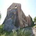
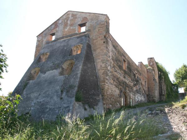
La historia del Ingenio de Maro comienza en 1582, cuando el licenciado Felipe de Armengol, abogado de la Audiencia de Granada, compró a Juan de Gricio Herrera el Señorío de Maro, y decidió implantar el cultivo de la caña de azúcar fabricando el primer ingenio azucarero en esta localidad, que se empezó a construir en 1585, abriendo también un camino desde Maro hasta Granada a través de la Sierra de Almijara. Este ingenio permaneció en funcionamiento hasta que lo paralizó un incendio ocurrido en los años sesenta del siglo XIX, fecha en la que ya consta en propiedad de la familia Pérez del Pulgar. Aunque ha sufrido remodelaciones y se encuentra en estado ruinoso, aún conserva este edificio parte de la sólida obra original, realizada mediante notables sillares de travertino que conforman sólidos muros, vanos y arcadas de medio punto y perfecto acabado, así como el poderoso contrafuerte o “pie de amigo” que lo apuntala por el lado del barranco.
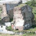
El Ingenio de “San Antonio Abad” fue el primer ingenio azucarero de Nerja, allá por el 1595 se tiene constancia que trabajaba a pleno rendimiento siendo propiedad de Juan de Briones y ha permanecido en funcionamiento hasta el siglo XIX. Durante una época tuvo anexo un molino harinero conocido como Tabalones. Este ingenio fue comprado por los Larios en 1872.
The Cave of Nerja is a natural archaeological formation originating from a type of calcified rock, known as Karst type rock, and which is home to a certain area where the rock rises up to form the thickest example in the world of a structure formed by the fusion of a stalactite and stalagmite, as certified by the Guinness Book of Records, 1989.
The Balcony of Europe is to be found on the top of the cliff which separates the beaches of Salón and Calahonda, where once was sited the "Castillo Bajo de Nerja", the lower of the castles to be found in Nerja, constructed at the beginning of the 16th Century. This castle underwent renovation the 18th century, during which a cannon battery was incorporated into the structure.
The boat named “La Dorada” (a play on words meaning both golden, or bream) used to fish for transparent goby fish, is perhaps the symbol most readily identified with the tourist trade in Nerja. It was the focal point of the “happy song” which the producer Antonio Mercero realised in Nerja at the beginning of the 1980s, broadcast on the Spanish television series “Verano Azul” (Blue summer).
The chapel of Our Lady of the Distressed, constructed in the Baroque style, was constructed in 1720 by Bernarda María Alférez, a member of the López de Alcántara family, originally from Granada and owner of the sugar refinery “San Antonio Abad”. She used the profits from the sugar refinery to fund the construction of the building and its subsequent maintenance.
The construction of The Church of Our Saviour finished in 1697, with the addition of a bell tower in 1724. There was a further period of extension to the original building at the end of the 18th century before being restored to its current state in 1997.
The Fountain dedicated to Europe is intended as a lasting symbol of and an inspiration towards, the strong commitment to Europe by the town of Nerja, the town of the Balcony of Europe, and the moment that Spain was incorporated into the old European Economic Community, today the European Union.
This fountain was constructed at the beginning of the 20th century, a project promoted by Francisco Cantarero who was at the time the mayor of Nerja, and coinciding with the first supply of drinking water to be installed in the old centre.
Maro is a beautiful, white village situated on the cliff tops overlooking the Bay of Nerja, between La Caleta and the Barranco de Maro; and between the Balcony of Europe and Cerro-Gordo.
La Iglesia de Nuestra Señora de las Maravillas, or The Church Of Our Lady of Wonders is documented to have been finished at the end of the 17th century although its architectural features suggest that it could have been based on the reuse of a previous structure or perhaps that it was finally concluded centuries after it was designed.
The cliffs of Maro-Cerro Gordo rise up where the Sierra Almijar “dips its feet” into the Mediterraneo.
The aqueduct of Águila was built at the end of the 19th century “in the style of the roman aqueducts” and was intended for irrigation and to carry water to the old sugar factory known as “Las Mercedes” or “San Joaquín”. The construction of this feature, as with the Cantarero Fountain, was thanks to the local craftsman D. Francisco Cantarero Senior, whose signature can still be seen, conserved next to the central shrine.
El Rapto de Europa or Europe's Kidnapping is the monument raised by the people of Nerja on the 26th January 1986, on the occasion of Spain's entry into the European Economic Community (now EU).
The location of “La Torrecilla” suggests that its first use was related to the line of coastal surveillance designed by the Narzaries, Muslim descendents of Yusuf ben Názar, the founder of a ruling dynasty in Granada, during the 13th century. However, the remains of the tower found today correspond to a later building, constructed in the 18th century to ward off Berberisco pirate invaders.
The beach known as “La Torrecilla” takes its name from the nearby small tower, the old watchtower, which is found on the western side of the beach. So far every year it has been honoured with the Blue Flag award of the European Union and the “Q” mark indicating that it conforms to certain quality levels defined for tourist beaches.
The beach at Burriana is the most famous beach of all of the coast of Nerja, thanks both to its amazing views at the beginning of the cliffas and for setting the scene for the famous television series “Verano Azul”.
The story of the Maro's sugar refinery begins in 1582, when it was licensed by Felipe de Armengol, lawyer to the court of Granada, bought from Juan de Gricio Herrera, the Lord of Maro, and decided to grow sugarcane, and so starting the first sugar refinery in the area, the construction of which was begun in 1585, opening at the same time a route from Maro to Granada, via the “Sierra de Almijara”. This refinery continued operating until a fire in the 1870's paralysed its work, at which point in time the refinary was now the property of the Pérez del Pulgar family. Despite undergoing various redesigns and now finding itself in a state of dilapidation, the building still conserves some of the original, strongly built building, realised by famed ashlars working with Travertino stone which constructed solid walls, spans and half-pointed arches, all perfectly finished, and similarly a powerful buttress or “friend's foot” which points towards the gully.
The refinery of “San Antonio Abad” was the first sugar refinery built in Nerja and around 1595 there is evidence that it worked at full capacity, being owned as it was by Juan de Briones, and continued in use until the 19th century. During this period it had an annexe containing a flour mill known as “Tabalones”. This refinery was bought by the Larios family in 1872.
La Cueva de Nerja es un yacimiento arqueológico natural de formaciones karsticas donde se alza la columna más gruesa del mundo formada por la fusión de una estalactita y una estalagmita, Record Guiness en 1989.
La Cavidad conserva estratos arqueológicos que abarcan unas cronologías entre 25.000 y 3.600 años antes del presente, que testimonian el paso de grupos humanos cazadores, recolectores y pescadores.
La Cueva de Nerja fue utilizada como hábitat, lugar de enterramiento de expresión de manifestaciones Culturales.
El arte rupestre en la Cueva se manifiesta en la pintura, con un registro de colorantes que van del rojo al negro. Entre los animales representados se encuentran caballos, ciervos, cabras, aves….
La cueva acoge el Festival Internacional de Música y Danza Cueva de Nerja en la segunda quincena de Julio. Está abierta todo el año excepto el 1 de enero y el 15 de mayo.
Teléfono Fundación Cueva de Nerja:
El Balcón de Europa se encuentra situado sobre el acantilado que separa las playas del Salón y Calahonda, donde estuvo situado el Castillo Bajo de Nerja, construido a comienzos del siglo XVI. Dicho castillo fue remodelado en el siglo XVIII para dotarlo de una batería para cañones.
Durante la Guerra de la Independencia, fue completamente destruido por los ingleses junto con La Torrecilla.
El rey Alfonso XII visitó Nerja el 20 de enero de 1885 con motivo del terremoto ocurrido en diciembre del año anterior, alabando la belleza del lugar y exclamando que se encontraba en el Balcón de Europa motivado por las impresionantes vistas que desde aquí se divisan. Recientemente se ha erigido una estatua del rey conmemorativa de esta circunstancia, que lo presenta apoyado en la balaustrada que se asoma al Mediterráneo. Fundida en bronce, es obra del escultor Francisco Martín. En sus jardines se encuentra un monumento que nos recuerda el descubrimiento de La Cueva de Nerja.
El diseño urbanístico del paseo ha cambiado en varias ocasiones a lo largo de los siglos XX y XXI.
El barco de Chanquete “La Dorada” es quizás el símbolo del pleno desarrollo turístico de Nerja. Es la gran protagonista del feliz canto, que el cineasta Antonio Mercero realizó a Nerja al comienzo de la década de los 80 del pasado siglo XX, a través de la serie de Televisión Española “Verano Azul”.
La Dorada primera, como aparece en la serie televisiva, fue durante el rodaje en 1981 refugio y vivienda del viejo lobo de mar “Chanquete”, que encarnó magistralmente el actor Antonio Ferrándis. Un año más tarde el actor rodaría la película “Volver a Empezar”, la primera producción española que se alzó con el Óscar de Hollywood a la mejor película de habla no inglesa.

Según los recientes descubrimientos arqueológicos de la Cueva de Nerja los primeros pobladores datan del Paleolítico al Bronce, pasando por el Epipaleolítico y Neolítico, con importantes restos humanos pertenecientes al Cro-Magnon.
Los primeros indicios históricos sobre la alquería de Naricha o Narija, son del período de la dominación árabe. Debió depender en algunos aspectos de Vélez Málaga , al igual que otros lugares de la zona, si bien eso no significa que no tuviese entidad propia. De hecho contaba con su propia fortaleza que se ubicaba en la zona hoy conocida como Pago del Castillo Alto, donde se situaba esta población árabe. Se pueden observar algunos restos del mismo en el ángulo formado por el camino de Frigiliana, en su cruce con el vecinal de la Cantera.
En la línea de la costa se levantó una torre en el siglo X, similar a las que existen en otros lugares de la costa.
Cuando en 1487 los musulmanes de Vélez se rindieron definitivamente al rey Católico, fueron seguidos en esta acción por los habitantes de la mayor parte de la Axarquía. En las Crónicas Cristianas se relata esta acción y entre los lugares mencionados se cita Narija, nuestra Nerja.
Terminada la rebelión de los moriscos, ya en el siglo XVI, se levantó una nueva fortaleza en el lugar ocupado por la torre costera del Balcón de Europa, que será demolida posteriormente por los franceses en el siglo XVIII. En torno a ella se concentró la población que había decidido abandonar su primitivo emplazamiento.
En el siglo XVI se construyó la ermita de Ntra. Señora de las Angustias, santuario dedicado a la Patrona de la villa. Este templo contiene frescos que cubren su cupula de estilo granadino.
En 1655 la población alcanza los 400 vecinos y tienen cuerpo urbano las calles Carmen, Iglesia, El Tajillo, Puerta del Mar, Plaza de Cavana, calle del Corralón, hoy Gómez, y comienza a trazarse calle Granada.
En 1660, siendo el alcalde D. Antonio de Villavicencio, el rey manda construir la Torre de los Guardas, hoy Balcón de Europa. En 1697 se termina la primera fase de la parroquia de El Salvador.
El 25 de Diciembre de 1884 hubo un enorme terremoto y con motivo de estos desagradables sucesos, S.M. el Rey Alfonso XII vino a visitar la zona afectada. Después de admirar el paseo de la "batería", lo llamó oficialmente "Balcón de Europa". También fue concedido el tratamiento de "Excelentísimo" al Ayuntamiento.
Durante las dos primeras décadas el siglo XX se construye el camino a Frigiliana y se urbaniza el Paseo Balcón de Europa. En 1930 se termina de urbanizar definitivamente el Balcón de Europa y las calles de la Cruz y Granada. En 1950 se inagura el Mercado Municipal.
El descubrimiento de la Cueva de Nerja en 1959 es símbolo del nuevo arranque y después viene el gran desarrollo turístico que trae progreso y prosperidad y que cambia la fisonomía de la vida social de Nerja.
Ayuntamiento de Nerja
C/. Carmen, 1 29780 Nerja (Málaga)
Teléfono: 95 254 84 00
Según los recientes descubrimientos arqueológicos de la Cueva de Nerja los primeros pobladores datan del Paleolítico al Bronce, pasando por el Epipaleolítico y Neolítico, con importantes restos humanos pertenecientes al Cro-Magnon.
Los primeros indicios históricos sobre la alquería de Naricha o Narija, son del período de la dominación árabe. Debió depender en algunos aspectos de Vélez Málaga , al igual que otros lugares de la zona, si bien eso no significa que no tuviese entidad propia. De hecho contaba con su propia fortaleza que se ubicaba en la zona hoy conocida como Pago del Castillo Alto, donde se situaba esta población árabe. Se pueden observar algunos restos del mismo en el ángulo formado por el camino de Frigiliana, en su cruce con el vecinal de la Cantera.
En la línea de la costa se levantó una torre en el siglo X, similar a las que existen en otros lugares de la costa.
Cuando en 1487 los musulmanes de Vélez se rindieron definitivamente al rey Católico, fueron seguidos en esta acción por los habitantes de la mayor parte de la Axarquía. En las Crónicas Cristianas se relata esta acción y entre los lugares mencionados se cita Narija, nuestra Nerja.
Terminada la rebelión de los moriscos, ya en el siglo XVI, se levantó una nueva fortaleza en el lugar ocupado por la torre costera del Balcón de Europa, que será demolida posteriormente por los franceses en el siglo XVIII. En torno a ella se concentró la población que había decidido abandonar su primitivo emplazamiento.
En el siglo XVI se construyó la ermita de Ntra. Señora de las Angustias, santuario dedicado a la Patrona de la villa. Este templo contiene frescos que cubren su cupula de estilo granadino.
En 1655 la población alcanza los 400 vecinos y tienen cuerpo urbano las calles Carmen, Iglesia, El Tajillo, Puerta del Mar, Plaza de Cavana, calle del Corralón, hoy Gómez, y comienza a trazarse calle Granada.
En 1660, siendo el alcalde D. Antonio de Villavicencio, el rey manda construir la Torre de los Guardas, hoy Balcón de Europa. En 1697 se termina la primera fase de la parroquia de El Salvador.
El 25 de Diciembre de 1884 hubo un enorme terremoto y con motivo de estos desagradables sucesos, S.M. el Rey Alfonso XII vino a visitar la zona afectada. Después de admirar el paseo de la "batería", lo llamó oficialmente "Balcón de Europa". También fue concedido el tratamiento de "Excelentísimo" al Ayuntamiento.
Durante las dos primeras décadas el siglo XX se construye el camino a Frigiliana y se urbaniza el Paseo Balcón de Europa. En 1930 se termina de urbanizar definitivamente el Balcón de Europa y las calles de la Cruz y Granada. En 1950 se inagura el Mercado Municipal.
El descubrimiento de la Cueva de Nerja en 1959 es símbolo del nuevo arranque y después viene el gran desarrollo turístico que trae progreso y prosperidad y que cambia la fisonomía de la vida social de Nerja.
Ayuntamiento de Nerja
C/. Carmen, 1 29780 Nerja (Málaga)
0034 95 254 84 00
La ermita de Nuestra Señora de las Angustias de estilo Barroco, fue fundada en 1720 por doña Bernarda María Alférez, miembro de la familia granadina de los López de Alcántara y también propietaria del ingenio azucarero “San Antonio Abad”. Con las rentas del ingenio azucarero se sufragaron los gastos de edificación y mantenimiento de la ermita.
El patronato de este pequeño santuario perteneció a los López de Alcántara durante el siglo XVIII y parte del XIX, hasta que en 1853 el Ayuntamiento de Nerja se hizo cargo del mismo.
Es una obra de mampostería y ladrillo, con una sola nave cubierta con bóveda de medio cañón con lunetos y capilla mayor con bóveda semiesférica sobre pechinas. En la cúpula hay magníficas pinturas murales al óleo, en la que están representadas la escena de Pentecostés, en las pechinas pinturas con los cuatro evangelistas, y en las pilastras y el arco triunfal pinturas con las virtudes teologales y cardinales, ángeles y roleos. Por último hay un camarín donde se encuentra la imagen de Nuestra Sra. de las Angustias, Patrona de Nerja precedida por un pórtico y una sencilla espadaña.
Tras su reciente estudio y restauración se atribuye esta obra a un pintor de la escuela granadina y ha sido fechada entre 1730 y 1750.
La iglesia de El Salvador se terminó de construir en 1697, edificándose su campanario en 1724. Fue ampliada a finales del siglo XVIII, siendo restaurada en su aspecto actual en 1997.
Es uno de los pocos templos del mundo con representaciones de los tres Arcángeles, siendo San Miguel el patrono de Nerja.
Se trata de un edificio de estilo barroco-academicista dividido en tres naves separadas por pilares y arcos de medio punto. La nave central se cubre con armadura mudéjar y las laterales con bóvedas de aristas y medio cañón en sus tramos delanteros. El crucero, que excede las naves laterales, se remata con cúpula semiesférica nervada.
La torre campanario está compuesta por tres cuerpos cuadrados y remate ochavado. Es interesante la solución arquitectónica de la pila de agua bendita, situada bajo el coro y concebida tomando como eje la columna central.
La fuente de Europa es el símbolo permanente y motivador de la vocación europeísta de la Villa de Nerja, pueblo del Balcón de Europa en el momento de la integración de España en la entonces C.E.E., hoy Unión Europea.
Dicho monumento tuvo la aceptación unánime del pleno del Consistorio nerjeño, la aprobación de la Comisión Europea de Bruselas, el consentimiento del Parlamento Europeo de Estrasburgo, y el apoyo de todos los estados miembros de la Unión Europea a través de sus embajadas y bajo el patrocinio español de la Comisión de la U.E. en Madrid. Asimismo, todas las provincias andaluzas también están presentes, formando parte del gran vaso central de la fuente.
Al gran monumento europeísta le dan forma 16 piedras, 15 de los países de la Unión Europea, enviadas gratuitamente al efecto, y una de Nerja, constituyendo una columna, que simboliza la unidad de las naciones que dieron su cultura a Occidente, y abre un futuro de paz, aparcando siglos pasados sin entendimiento, para bien de sus ciudadanos. Una Europa Unida, que imprimirá al mundo un estilo de auténtica libertad y democracia donde el pueblo será el verdadero soberano de sus decisiones y futuro.

La fuente Cantarero fue construida a principios del siglo XX, promovida por Don Francisco Cantarero siendo alcalde de Nerja, en relación con el primer abastecimiento de agua potable en el casco urbano.
Don Francisco Cantarero construyó también en las inmediaciones de esta fuente la fábrica de mieles llamada “El Progreso”. La fuente ha cambiado varias veces de lugar y de fisonomía a lo largo de los últimos años.

Maro es un hermoso y blanco pueblo que está situado sobre los acantilados de la bahía de Nerja, entre la Caleta y el Barranco de Maro; entre el Balcón de Europa y Cerro-Gordo.
Según los historiadores sitúan a la actual Maro en la Detunta Romana, entre Sexi (Almuñécar) y Claviclum (Torrox), junto a la vía romana de Cástulo a Malaca por Orgi. Entonces era una pequeña villa o factoría dedicada al comercio.
Durante el período musulmán, fue una pequeña alquería dedicada a la agricultura e industria derivada con productos como la seda y la miel de caña de azúcar.
En su vega del Sanguino se dan los mejores frutos tropicales de la zona y, según investigaciones aunque sin rigor histórico, su nombre se debe a una pequeña batalla que tuvo lugar, en el reinado de Felipe II, entre Hernando el Darra y el capitán Antonio de Luna. Este hecho tuvo lugar en 1570 y debió desarrollarse en el arroyo de este nombre, salida natural de la Sierra Almijara hacia la caleta de Maro.
A mediados del siglo XVII Maro era Señorío, siendo su señor más notable D. Lucas Navío de la Peña.
También hay otro hecho histórico, llegado por transmisión oral, en que se señala la visita del Cardenal Cisneros a esta zona y que pernoctó en una torre fortificada, que existió donde hoy está la “Casa Grande”.
Maro tuvo una de sus etapas más prósperas en el primer tercio del siglo XIX con la exportación de los frutos extra-tempranos. Hoy, sin dejar de ser un pueblo que vive de la agricultura, se abre hacia el turismo.
La iglesia de Nuestra Señora de las Maravillas, se tienen noticias de que se terminó a finales del S. XVII, aunque sus características arquitectónicas sugieren que pudo reutilizarse una estructura previa o bien que su conclusión se llevó a cabo siglos después de ser diseñada.
La iglesia restaurada en 1887 se levanta sobre una sola nave que posee cubierta de parhileras. Su puerta, ventanas y arcadas interiores son ojivales. Su torre se remata con chapitel piramidal y tiene en su frente una pequeña espadaña. Al exterior, esta torre aparenta ser maciza y estar compuesta de varios cuerpos escalonados, aunque en realidad consta sólo de dos pisos, cuyas estructuras internas son huecas y de paredes verticales, estando el inferior incluido en la iglesia a modo de pequeña estancia cúbica a la que se accede por un arco apuntado.
El segundo piso, en cuyo interior se aprecia la mampostería de piedra y ladrillos en verdugadas, cuenta también con un arco de acceso semejante y superpuesto al anterior, aunque actualmente permanece cegado. Probablemente este cuerpo estuvo dividido en dos plantas de madera actualmente desaparecidas, como indican los mechinales de la pared. La torre tenía una puerta que daba a la calle, orientada hacia el norte, actualmente semioculta por unas escalinatas.
En el interior de este templo de estilo ecléctico se venera la imagen de la Virgen de las Maravillas, Patrona de Maro.

Los Acantilados de Maro-Cerro Gordo aparecen donde la Sierra Almijara hunde sus pies en el Mediterráneo.
Constituyen un enclave privilegiado de inusitada belleza por lo que han merecido ser declarados Paraje Natural por la A.M.A. desde 1989. Cuentan con una extensión de 375 hectáreas incluyendo un kilómetro mar adentro. Se pueden recorrer a pie desde la carretera nacional N-340.
Sus calas son: Cala Barranco de Maro, Playa de la Caleta, Playa de Maro, Torre de Maro, Playa Molino de Papel y Playa el Cañuelo, esta última con un servicio de jeeps en verano que realizan la bajada a la misma playa.
El acueducto del Águila fue construido a finales del siglo XIX “a la manera de los acueductos romanos” y se creó para el regadío y para llevar agua a la antigua fábrica de azúcar “Las Mercedes” o “San Joaquín”. Al igual que esta última, su construcción se debe al maestro local D. Francisco Cantarero padre, cuya firma se conserva aún grabada junto al templete central.
En el frente del acueducto, en la cara interior orientada hacia el norte por donde pasaba el antiguo camino, hay una galería de arcos ciegos de herraduras apuntadas que rememoran al estilo mudéjar. En la parte central se levantan cuatro pisos superpuestos de arcadas de ladrillo que conforman un total de 37 arcos de medio punto y un pequeño templete donde se lee con dificultad la inscripción “PURA Y LIMPIA CONCEPCIÓN”, que se remata con una veleta en la que se recorta el águila bicéfala que da nombre a su construcción.
El acueducto permanece en uso y se encuentra en la antigua carretera nacional N-340, a 400 metros aproximadamente antes de Maro viniendo desde Nerja.

El Rapto de Europa es el monumento erigido por el pueblo de Nerja el 26 de Enero de 1986, con motivo de la adhesión de España a la Comunidad Económica Europea (Unión Europea).
Al acto de la inauguración asistieron representantes de las Embajadas de la C.E.E. en Madrid. La bandera de la C.E.E. fue izada por el periodista Ricardo Utrilla Carlón, a la sazón presidente de la Agencia EFE, por invitación expresa del Alcalde, Antonio Villasclaras Rosas.
El autor de la escultura es el artista andaluz Aurelio Teno Teno. Es una obra muy peculiar, dentro del expresionismo figurativo del referido escultor, que representa a un toro (Zeus) que en vez de raptar a Europa, representada por una mujer andaluza en actitud de lucha, la salva, como símbolo de la sociedad actual.
Abre la entrada Oeste del casco urbano, como manifiesto de la España democrática a su vinculación a Europa y al mundo libre.

El emplazamiento de La torrecilla se cree que su primera utilización estuviera relacionada con la línea de vigilancia costera diseñada por los nazaríes durante el siglo XIII. Sin embargo, los restos que aún nos quedan de esta torre corresponden a un edificio posterior, levantando en el siglo XVIII para hacer frente a las incursiones de los piratas berberiscos.
Se trataba de una torre reducto no cimentada, realizada mediante mampostería de piedras con ladrillos en verdugadas. Tenía planta semicircular con retreta retranqueada y sección troncocónica. Su altura original sería de 11 m., con una anchura máxima de 15 m. Conocemos el estado que presentaba esta torre a comienzos del siglo XIX gracias a los dibujos conservados en el proyecto de consolidación de su base firmado por D. Nicolás Garrido en 1807. En el proyecto se rellenan las galerías abiertas por filtraciones en la soporta y se propone un encajonamiento exterior de mampostería para evitar su ruina. Durante la Guerra de la Independencia es volada por los ingleses, entonces aliados en España, para evitar que fuera utilizada por el ejército francés.

La playa La Torrecilla recibe el nombre de la torre pequeña, antigua torre vigía, que encontramos en el lado oeste de la playa. Es distinguida cada año con la Bandera Azul de la UE y La Q de Calidad Turística en Playas.

La playa de Burriana es la playa más famosa de toda la costa nerjeña, bien por sus maravillosas vistas al comienzo de los acantilados o por que fue escenario de la famosa serie “Verano Azul”.
En ella podemos disfrutar de un agradable paseo por su extenso paseo marítimo donde encontramos chiringuitos donde poder disfrutar de nuestros famosos espetos.
En el año 2004 fue una de las dos playas andaluzas distinguidas con la Q de Calidad Turística en Playas, certificado que conserva en la actualidad. También es distinguida cada año con la Bandera Azul de la UE.
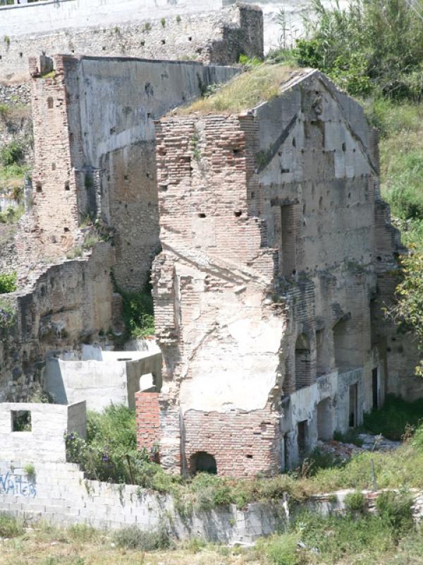
La historia del Ingenio de Maro comienza en 1582, cuando el licenciado Felipe de Armengol, abogado de la Audiencia de Granada, compró a Juan de Gricio Herrera el Señorío de Maro, y decidió implantar el cultivo de la caña de azúcar fabricando el primer ingenio azucarero en esta localidad, que se empezó a construir en 1585, abriendo también un camino desde Maro hasta Granada a través de la Sierra de Almijara. Este ingenio permaneció en funcionamiento hasta que lo paralizó un incendio ocurrido en los años sesenta del siglo XIX, fecha en la que ya consta en propiedad de la familia Pérez del Pulgar. Aunque ha sufrido remodelaciones y se encuentra en estado ruinoso, aún conserva este edificio parte de la sólida obra original, realizada mediante notables sillares de travertino que conforman sólidos muros, vanos y arcadas de medio punto y perfecto acabado, así como el poderoso contrafuerte o “pie de amigo” que lo apuntala por el lado del barranco.
El Ingenio de “San Antonio Abad” fue el primer ingenio azucarero de Nerja, allá por el 1595 se tiene constancia que trabajaba a pleno rendimiento siendo propiedad de Juan de Briones y ha permanecido en funcionamiento hasta el siglo XIX. Durante una época tuvo anexo un molino harinero conocido como Tabalones. Este ingenio fue comprado por los Larios en 1872.
Queremos darte la bienvenida e invitarte a que conozcas nuestras actividades y servicios: senderismo, piragüismo, kayack, barranquismo, escalada, equitación, excursiones nocturnas, cursos de orientación en la naturaleza...
Además te ofrecemos la posibilidad de suscribirte a nuestras actividades y noticias, para que estés siempre al día de las últimas novedades de Educare Aventura.
Y si eres agente de viajes te ofrecemos la posibilidad de contratar nuestras actividades On-Line, dándote de alta en nuestro servicio reserva exclusivo.
¡Disfruta de la naturaleza con nosotros!
Teléfono: + 34 600 620 054
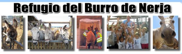
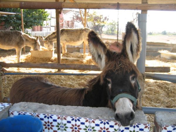
Bienvenidos a la nueva web del Nerja Burros. esperamos que os guste.
Estamos añadiendo nuevos contenidos todo el tiempo así que por favor revise más tarde.
Si desea compartir la nueva página web con sus amigos (que realmente, realmente ayudar a los burros), por favor haga clic en uno, o más, por el Facebook, twitter y los botones + compartir en la parte inferior de esta página y todos!
Estamos abiertos todos los días a los visitantes de 10-14 y otra vez a partir de 17 a 18 horas
Venga y visite nuestro burros rescatados y darles de comer unas zanahorias!
Gracias por su apoyo.
Teléfono: 664 558 133
Web: www.nerjarefugiodelburro.es
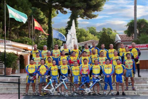
El club ciclista Narixa se fundó en 1998 con el objetivo de promover el deporte del ciclismo en Nerja tanto en carretera como en montaña.
La cantidad de socios que han pasado por nuestro club demuestra la gran aceptación por parte de los aficionados al ciclismo que estamos teniendo, siendo en la actualidad mas de 50 socios. La variedad del perfil de nuestros socios es variada ya que contamos con socios que compiten a nivel Andaluz, otros no compiten pero les gusta entrenar para tener buen nivel dentro del mundo de la bicicleta, otros les gusta practicar el ciclismo para mantenerse en forma y otros simplememente les gusta pasear en bicicleta. Estamos abiertos a todo el aficionado de la bicicleta que quiera ser socio sea cual sea su nivel.
Todos los domingos tenemos como actividad excursiones colectivas por carretera ya programada con anterioridad en nuestro calendario. Tenemos dos ciclos de 5 excursiones colectivas puntuables para ver el estado de forma de cada socio, una en verano y otra en invierno las cuales llamamos “Test de forma Club Ciclista Narixa” donde vemos el nivel de cada uno, teniendo después una cena con sorteo de regalos .
Para participar en las excursiones colectivas del club es requisito indispensable ser socio federado en la fecha de la actividad.
Contamos con un seguro de responsabilidad civil (sólo para la práctica del ciclismo) a disposición de nuestros socios.
Desde aquí recomendamos a todos los practicantes de nuestro deporte favorito el cuidado por el medio ambiente , la precaucion y respeto por las normas de tráfico.
Teléfono: 679 14 54 82
Web: www.clubciclistanarixa.es
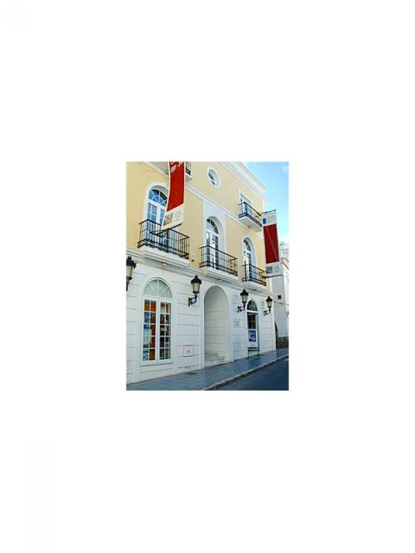
Reseña Histórica del Edificio de Calle Granada, 45
La parcela, donde hoy se levanta el edificio del Centro Cultural Villa de Nerja, albergó en las décadas de los veinte y treinta del pasado siglo un molino de aceite o almazara, cuyo propietario era Francisco Ortega. En los años cuarenta la adquirió el entonces vecino de esta localidad Bautista Bueno Jimena para construir un edificio dedicado a vivienda y comercio, que más tarde se amplió a gestoría.
En 1951 fue vendida a la Caja de Ahorros y Préstamos de Antequera, y esta entidad a su vez la cedió al Ayuntamiento en 1966 para la construcción de centro cultural. El Ayuntamiento lo utilizó entre 1966 y 1972 como Colegio Libre Adoptado, donde se impartieron enseñanzas de bachillerato, y a partir de 1972 se ubicó en el edificio el Colegio Público San Fernando, que al final de la década de los setenta se integró en el C.P. San Miguel, derribándose posteriormente el edificio para la construcción del Centro Cultural Villa de Nerja, que se inauguró el 16 de Mayo de 1998.
Teléfono: 95 252 38 63
Web: www.nerja.es/villadenerja
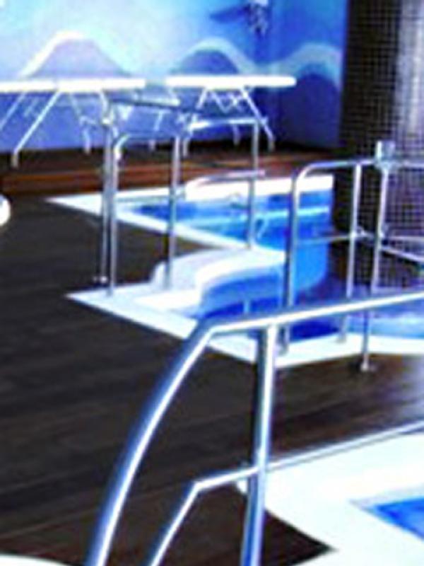
PARAÍSO DE AGUA somos el primer balneario urbano de la costa del sol oriental.
Un lugar exclusivo donde recuperamos la cultura del agua especialmente para ti, para que disfrutes de sus propiedades como hacían nuestros antepasados y por un rato te encuentres contigo mismo aislado de la rutina diaria.
Podrás hacer uso de nuestro balneario sin necesidad de estar alojado en ningún hotel especialmente, ni tener que ser socio de algún club.
Puedes utilizarlo libremente independientemente de dónde te alojes.
Vengas sólo o acompañado de tus amigos, te garantizamos que la experiencia será muy gratificante.
Teléfono: 952 52 84 80
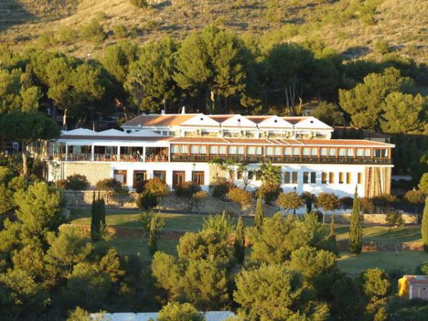
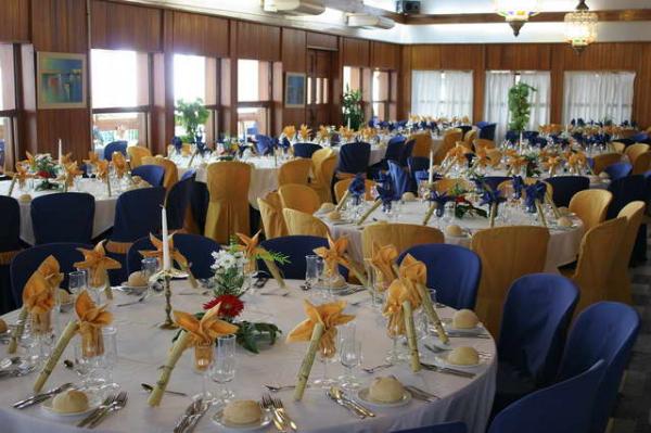
En el paraje natural de las Cuevas de Nerja se levanta este amplio restaurante. La terraza, con vistas a las cuevas, y su comedor se pueblan con grupos de turistas. Para hacer frente a paladares tan diversos en los fogones de la casa se elabora una variada cocina internacional. El restaurante también es sede de una b de Cocina, en la que muchos aspirantes al título de chef estudian durante dos años.
Tipo de cocina: Española
Precio: de 15 a 25 euros.
Especialidad: Piña con langostinos
Teléfono: 952 52 96 00
Web: www.lorenzoreche.net
*Fumadores: Zonas habilitadas
*Abierto domingo: Sí
*Terraza: Sí
*Días de Cierre: Abierto todos los días
*Notas: Aparcamiento
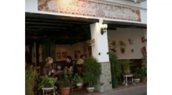
Decorado con un típico estilo andaluz, El Viejo Sótano forma parte del complejo de apartamentos Pepe Mesa, ubicado en pleno centro de Nerja. Su especialidad son las delicias de la cocina de la Axarquia, entre las que destacan sus platos de salmones y otros pescados frescos.
Tipo de cocina: Española
Precio: de 15 a 25 euros.
Especialidad: Salmón a la pimienta verde
Dirección: Los Huertos, 33, 29780, Nerja
Teléfono: 952 52 41 38
Web: www.pepemesa.com/restaurante_sotano.html
*Fumadores: Zonas habilitadas
*Abierto domingo: Noche
*Días de Cierre: Domingos por la mañana
Un restaurante agradable donde disfrutar de la buena cocina. Sabores delicados en platos muy cuidados. Una decoración exquisita y un gran servicio.
Tipo de cocina: Española
Precio: menos de 15 euros.
Especialidad: Roast Beef
Dirección: Los Huertos, 74 (bajo A), 29780, Nerja
Teléfono: 952 52 52 20
*Fumadores: Zonas habilitadas
*Abierto domingo: Si
*Terraza: Sí
*Notas: Menú diario 9 euros aproximadamente
The Cave of Nerja is a natural archaeological formation originating from a type of calcified rock, known as Karst type rock, and which is home to a certain area where the rock rises up to form the thickest example in the world of a structure formed by the fusion of a stalactite and stalagmite, as certified by the Guinness Book of Records, 1989.
The cavity is an example of archaeological stratification which spans a period from 25,000 to 3,600 years ago, that bear witness to the passage of our hunter-gatherer ancestors and of their fisherman counterparts.
The cave in Nerja was used as an abode, a burial place and as a centre point for cultural rituals.
The cave paintings found on the site make use of a range of coloured pigments ranging from red to black. Amongst the animals depicted we can find horses, deer, goats, birds…
The cave is the site chosen for the “Nerja Cave, International Festival of Music and Dance” which takes places during the second fortnight of July.
The cave is open all year round apart from the 1st January and the 15th May.
Foundation Nerja´s Cave phone:
The Balcony of Europe is to be found on the top of the cliff which separates the beaches of Salón and Calahonda, where once was sited the "Castillo Bajo de Nerja", the lower of the castles to be found in Nerja, constructed at the beginning of the 16th Century. This castle underwent renovation the 18th century, during which a cannon battery was incorporated into the structure.
During the War of Independence the English completely destroyed the castle, along with that of La Torrecilla.
King Alfonso XII visited Nerja on the 20th January 1885 to inspect the damage caused by an earthquake in December of the previous year, praising the beaty of the town and exclaiming that he found himself to be inspired by the stunning views obtained from the vantage point of "Europe's Balcony".
A statue has been erected recently to commemorate the visit by Alfonso XII, depicting the king leaning against a balustrade which looks out upon the Mediterranean sea. Cast in bronze, the statue is the work of the sculptor Francisco Martín. Whilst in the gardens we find a monument that records the discovery of the Cave of Nerja.
The urban layout of the front has been changed on numerous occasions throughout the 20th and 21st century.
The boat named “La Dorada” (a play on words meaning both golden, or bream) used to fish for transparent goby fish, is perhaps the symbol most readily identified with the tourist trade in Nerja. It was the focal point of the “happy song” which the producer Antonio Mercero realised in Nerja at the beginning of the 1980s, broadcast on the Spanish television series “Verano Azul” (Blue summer).
The first “La Dorada” as shown in the television series, served during the filming in 1981 as refuge and abode for the old seadog “Chanquete”, played tremendously by the actor Antonio Ferrándis. A year later the actor filmed “Volver a Empezar”, the first Spanish production to be awarded an Oscar by Hollywood in the category of "Best Foreign Language Film".
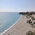
A place still exists on the Costa del Sol which lies between small coves untouched by development and surrounded by an impressive mountain scenery. At the easterly end of the province, only 50kms. From Málaga and within 1 ½ hours drive of Granada, you will find Nerja, the touristic capital of the Axarquia.
With its mild climate, you can enjoy yourself to the full all year round and take advantage of the relaxed way of life of a village that still retains much of the character of its moorish past. Today, Nerja offers an excellent range of quality accommodation and leisure time facilities. There are thirtieen Kms. of beaches, including the internationally famous Burriana beach that has once again been awarded by the Blue Flag of the European Union and the small coves below the impressive cliffs of Maro, which have been the inspiration of numerous artists who have set up residence here.
Lovers of the nature can enjoy the wonderful countryside in the area, camping at the campsite or in the camping zone in the parkland. For those who seek arternative activities on their holidays, there is fishing, diving, waterskiing, canoeing, water bikes, hiking, cycling, horseriding, jeep safaris, paragliding and much mores... with authorized services from full guarantee.
The historic centre, than begins in the Balcón de Europa (Balcony of Europe), was constructed around 1487. Former 9th Century Castle, it is now a viewing point above the sea. To the side of the Balcón, you will find the 17th Century El Salvador Church, constructed in baroque-mudejar style. You may also visit the 16th Century Nuestra Señora de las Angustias Hermitage with its paintings by the master Alonso Cano.
In the old quarter of town, typical small shops offer local craftworks and products of the area, including the sweet wine and olive oil, honey and tropical fruits. At the beach and fish restaurants you can enjoy the “pescaito frito” (fried fish), whilst the many international restaurants in town offer a wide variety of menus to suit all tastes.
Nerja retains its traditional festivals: the Fair, Holy Week (Easter), the San Isidro pilgrimage and the festivals of San Juan and Día del Carmen are also celebrated in their own special way. There are a wide range of cultural events throughout the year. Of particular note is the acclaimed “Nerja Caves Festival”, wich takes place amongst stalactites and stalagmites, wich were formed over millions of years. The Nerja Caves are currently the 3rd most visited monument in the whole3rd most visited monument in the whole of Spain.
Ayuntamiento de Nerja
C/. Carmen, 1 29780 Nerja (Málaga)
0034 95 254 84 00
The chapel of Our Lady of the Distressed, constructed in the Baroque style, was constructed in 1720 by Bernarda María Alférez, a member of the López de Alcántara family, originally from Granada and owner of the sugar refinery “San Antonio Abad”. She used the profits from the sugar refinery to fund the construction of the building and its subsequent maintenance.
The patrons of this small sanctuary were the López de Alcántara family during the 18th and some of the 19th century, up until 1853 when responsibility for the chapel passed to Nerja's town council.
The structure is comprised of masonry and brickwork, with a nave over which spans a vaulted ceiling with a half-seam and small windows and the main chapel with a hemispherical vaulted ceiling above a shell type motif. The dome features magnificent oil paintings representing the Pentecost, whilst in the shells one can see pictures of the four Evangelists, and on the capitals and the triumphal arch pictures of the cardinal and theological virtues, angels and decorative swirls and spirals. Finally there is a dressing room where one can find a depiction of Our Lady of The Distressed, Patron saint of Nerja behind a portico and the belfry.
Following a recent study and subsequent restoration of the painting the work has been attributed to a painter trained in Granada and has been dated between 1730 and 1750.
The construction of The Church of Our Saviour finished in 1697, with the addition of a bell tower in 1724. There was a further period of extension to the original building at the end of the 18th century before being restored to its current state in 1997.
It is one of the few places of worship in the world with depictions of the three archangels, amongst whom Saint Michael is the patron saint of Nerja.
The building displays an academically Baroque style, divided into three naves separated by pillars and half-pointed arcs. The central nave has a Mudejar framework covering (a style dominated by Moorish influenced motifs present in architecture after the Reconquest of Spain from the moors by the Catholic Kings) whilst its sides contain vaults with groins and half-seams in the foremost parts. The transept, which overhangs the naves on either side, is touched off with a hemispherical dome with characteristic structural ribbing.
The bell tower is made up of three cubic bodies culminating in an octagonal detail. An interesting architectural feature is the design of the font for the holy water, situated beneath the choir and designed in such a way that its central axis is shared with that of the church's central column.
The Fountain dedicated to Europe is intended as a lasting symbol of and an inspiration towards, the strong commitment to Europe by the town of Nerja, the town of the Balcony of Europe, and the moment that Spain was incorporated into the old European Economic Community, today the European Union.
Construction of the said monument gained unanimous approval at a meeting of Nerja's consistory, along with that of the European Commision in Brussels, and of the European Parliament in Strasbourg, not to mention the support of all the EU member states, communicated through their respective embassies and under the Spanish patronage of the EU Commision in Madrid. At the same time, all of the andalucian provinces are represented in the fountain, forming part of the main central basin of the fountain.
The grand monument to Europe is formed of sixteen stone blocks, fifteen of which have been sent from each one of the 15 member states (as they were then) of the EU, presented as gifts to the project and one stone from Nerja which is used as a column, symbolizing the unity of the nations that contributed to western culture, and looking forward to a peaceful future, leaving aside centuries of misunderstanding, for the good of their citizens. A Europe united, that aims to make its mark on the world with its aims of true liberty and democracy, where the people shall be the true sovereign entity in taking decisions and determining its future.
This fountain was constructed at the beginning of the 20th century, a project promoted by Francisco Cantarero who was at the time the mayor of Nerja, and coinciding with the first supply of drinking water to be installed in the old centre.
Francisco Cantarero also constructed, in the area surrounding this fountain, the honey factory known as “El Progreso”. The fountain has changed not only its location but also its appearance various times over the years.
Maro is a beautiful, white village situated on the cliff tops overlooking the Bay of Nerja, between La Caleta and the Barranco de Maro; and between the Balcony of Europe and Cerro-Gordo.
Historians nowadays site the current town as lying upon the Detunta Romana, between the ancient roman towns of Sexi (now Almuñécar) and Claviclum (present day Torrox), next to the roman road of Cástulo on the route to Malaga via Orgi. In those days it was a small hamlet or factory dedicated to trade.
During the period of Muslim rule, existed a small rural dwelling dedicated to agriculture and industry related to silk and the production of honey from sugarcane.
On the nearby flats, Sanguino, the best tropical fruits to be found in the local area are grown and according to research, even if lacking in historical rigour, they derive their name from a small battle which took place here during the reign of Felipe the Second, between Hernando el Darra and Captain Antonio de Luna. This event took place in 1570 and is assumed to have taken place near the stream of this name, the natural mouth of the Sierra Almijara in the direction of the cove of Maro.
Towards the middle of the 17th century Maro was dominion, and its most notable Lord was D. Lucas Navio de la Peña.
Another interesting fact, passed town to us by word of mouth, tells of the visit of Cardinal Cisneros to the area, who is said to have passed the night in a fortified tower which existed on the present day site of the “Casa Grande”
Maro experienced on the most profitable periods during the first third of the 19th century, exporting as it did the early flowering fruits. Today, without leaving behind its agricultural roots, Maro is beginning to open up to tourism.
La Iglesia de Nuestra Señora de las Maravillas, or The Church Of Our Lady of Wonders is documented to have been finished at the end of the 17th century although its architectural features suggest that it could have been based on the reuse of a previous structure or perhaps that it was finally concluded centuries after it was designed.
The church was restored in 1887 and is constructed around a single nave with double beading. Its door, windows and internal arches are formed by the joining at an angle of two arches. Its tower is crowned with pyramid shaped capitals and has incorporated into is front face a small belfry. From the outside, the tower appears to be solid and to be made up of various components slotted together in a step like manner although in reality it has only two floors, the internal structures of which are hollow with vertical wall, with the lower floor being incorporated into the church in the form of a small cubical room, which one accesses by means of a pointed arch.
The second floor, from within whose interior you can make out the lines of the stone and brick work, also contains an arc used for access in a similar manner to the aforementioned one in the lower floor and directly above it, although nowadays it is permanently sealed.
It is likely that this entity was once divided in two wooden floors which have long since disappeared, a theory suggested to us by the holes left in the wall by this supposed structure. The tower contained a door that led on to the street, facing towards the north and currently semi-hidden by a small stairway.
In the interior of the church constructed in the Eclectic style believers venerate the image of Our Lady of Wonders, Patron of Maro.
The cliffs of Maro-Cerro Gordo rise up where the Sierra Almijar “dips its feet” into the Mediterraneo.
They constitute a privileged enclave of outstanding beauty for which they have been deemed worthy of being declared a Natural Beauty Spot by the A.M.A. Since 1989. The site occupies an area of 375 hectares, including a distance of 1km from the shoreline out towards the open sea. The area can be walked taking as a starting point the national road N-340.
The coves of the area are named and include Cala Barranco de Maro, Playa de la Caleta, Playa de Maro, Torre de Maro, Playa Molino de Papel and Playa el Cañuelo, the last of these offers Jeeps to hire during summer as a means of descending towards its beach.
The aqueduct of Águila was built at the end of the 19th century “in the style of the roman aqueducts” and was intended for irrigation and to carry water to the old sugar factory known as “Las Mercedes” or “San Joaquín”. The construction of this feature, as with the Cantarero Fountain, was thanks to the local craftsman D. Francisco Cantarero Senior, whose signature can still be seen, conserved next to the central shrine.
At the front of the aqueduct, on the interior facing side looking towards the north and the old route, there is a gallery of filled-in arches with a horseshoe shape reminiscent of the Mudejar style. Rising up from the central part are four levels of brick-built arches making up in total 37 half-pointed arches and a small shrine, where if you look carefully you can just about read the inscription “Pure and immaculate conception”, crowned with a small wind vane in which is formed the shape of a two-headed eagle, the eagle which lends its name to the building.
The aqueduct remains in use and can be found on the old national highway N-340, approximately 400 m. before arriving at Maro when travelling from Nerja.
El Rapto de Europa or Europe's Kidnapping is the monument raised by the people of Nerja on the 26th January 1986, on the occasion of Spain's entry into the European Economic Community (now EU).
Guests at the inauguration act included representatives from the embassies of the C.E.E. in Madrid. The flag of the C.E.E. was raised by the journalist Ricardo Utrilla Carlón, who at that time was the president of the news agency EFE, by express invitation of the mayor, Antonio Villasclaras Rosas.
The author of the sculpture is the andalucian artist Aurelio Teno Teno. It is a very peculiar work, fitting into the figurative expressionist style associated with this sculptor, which represents a bull (Zeus) which instead of kidnapping Europe (represented by an Andalucian woman in a fighting stance, actually saves her, in this way representing the view of the sculptor of the situation at that time.
It stands at the entrance to the western side of the historic centre, representing democratic Spain and its links with Europe and a free world.
The location of “La Torrecilla” suggests that its first use was related to the line of coastal surveillance designed by the Narzaries, Muslim descendents of Yusuf ben Názar, the founder of a ruling dynasty in Granada, during the 13th century. However, the remains of the tower found today correspond to a later building, constructed in the 18th century to ward off Berberisco pirate invaders.
The tower itself is a dry-stone wall, fortified tower, realised through a combination of stone masonry combined with brick. It had a semicircular floor with a recessed retreat and a shortened conical section. Its original height would have been 11m with a maximum width of 15m. The aspect that the tower presented at the beginning of the 19th century is known thanks to original drawings that persist from the time of a project carried out to consolidate the structure's foundations, carried out under the direction of D. Nicolás Garrido in 1807. The project involved filling in the open with a supportive substrate and a securing of the exterior masonry is proposed to avoid the building degenerating into ruins. During the War of Independence the tower was blown up by the English, at that time allies of the Spanish, in order to avoid it being used by the invading French army.
The beach known as “La Torrecilla” takes its name from the nearby small tower, the old watchtower, which is found on the western side of the beach. So far every year it has been honoured with the Blue Flag award of the European Union and the “Q” mark indicating that it conforms to certain quality levels defined for tourist beaches.
The beach at Burriana is the most famous beach of all of the coast of Nerja, thanks both to its amazing views at the beginning of the cliffas and for setting the scene for the famous television series “Verano Azul”.
On this beach we can enjoy a pleasing walk along its extensive seafront where we can find beach bars where it is possible to try and enjoy our famous “espetos”, food cooked on a spit.
In 2004 Burriana Beach was one of the two andalucian beaches distinguished with the award of a “Q” award quality standard for tourist beaches, an award which it maintains to this day. As well as this it is awarded every year the EU award for beach cleanliness, as indicated by the Blue Flag award.
The story of the Maro's sugar refinery begins in 1582, when it was licensed by Felipe de Armengol, lawyer to the court of Granada, bought from Juan de Gricio Herrera, the Lord of Maro, and decided to grow sugarcane, and so starting the first sugar refinery in the area, the construction of which was begun in 1585, opening at the same time a route from Maro to Granada, via the “Sierra de Almijara”. This refinery continued operating until a fire in the 1870's paralysed its work, at which point in time the refinary was now the property of the Pérez del Pulgar family. Despite undergoing various redesigns and now finding itself in a state of dilapidation, the building still conserves some of the original, strongly built building, realised by famed ashlars working with Travertino stone which constructed solid walls, spans and half-pointed arches, all perfectly finished, and similarly a powerful buttress or “friend's foot” which points towards the gully.
The refinery of “San Antonio Abad” was the first sugar refinery built in Nerja and around 1595 there is evidence that it worked at full capacity, being owned as it was by Juan de Briones, and continued in use until the 19th century. During this period it had an annexe containing a flour mill known as “Tabalones”. This refinery was bought by the Larios family in 1872.
We welcome you and invite you to know our services and activities: hiking, canoeing, kayaking, canyoning, climbing, horseback riding, night tours, orientation courses in nature ...
We also offer the possibility to subscribe to our activities and news, to keep you up to speed with the latest news from Educare Aventura.
And if you're a travel agent we offer the possibility of hiring our online activities, giving you up for our exclusive booking service.
Enjoy nature with us!
Phone: + 34 600 620 054
Welcome to the new Nerja Donkey Sanctuary website, we hope you like it. We’re adding new content daily so please check back.
If you want to share the new website with your friends (which would really, really help the donkeys) then please click one, or more, of the like, tweet and +share buttons at the bottom of this and every page!
We are open every day to visitors from 10-2 and again from 5-6pm
Come and visit our rescued donkeys and feed them some carrots!
Thanks for your support
Phone: 664 558 133
Web: www.nerjarefugiodelburro.es
The Narixa cycling club founded in 1998 with the aim of promoting the sport of cycling in Nerja both road and mountain.
The number of members who have gone through our club demonstrates the wide acceptance of cycling enthusiasts are having, it is currently more than 50 members. The variety of the profile of our partners is varied and we have members competing at Andaluz, others do not like to compete but to have good level training in the world of cycling, others like cycling to keep fit and other Simpleman like biking. We are open to all cycling enthusiast who wants to be a member regardless of their level.
Every Sunday we have as a collective activity, road trips as previously scheduled on our calendar. We have two cycles of 5 scoring group excursions to see the fitness of each partner, one in summer and a winter which we call "Test form Narixa Cycling Club" where we see the level of each, after having dinner with raffle of gifts.
To participate in group excursions club membership is a prerequisite to be federated at the date of the activity.
We have a civil liability insurance (only for cycling) available to our members.
From here we recommend all our favorite sport practitioners care for the environment, caution and respect for traffic rules.
Phone: 679 14 54 82
Web: www.clubciclistanarixa.es
Brief History of Granada Street Building, 45
The plot, where now stands the building of the Villa de Nerja Cultural Centre, housed in the twenties and thirties of last century oil mill or mill, owned by Francisco Ortega. In the forties was bought by the then resident of this town Well Jimena Bautista to construct a building dedicated to housing and commerce, which later was extended to agency.
In 1951 it was sold to the Savings and Loan Antequera, and this entity in turn ceded it to the City Council in 1966 to build a cultural center. The City Council used it between 1966 and 1972 as Adopted Free School, where students are educated in high school, and from 1972 the building was located in the Public School San Fernando, at the end of the seventies was integrated into the CP San Miguel, then the building fell down for the construction of Villa de Nerja Cultural Centre, which opened on May 16, 1998.
Phone: 95 252 38 63
Web: www.nerja.es/villadenerja
WATER PARADISE are the first urban spa in the eastern Costa del Sol.
A unique place where we recover the culture of water especially for you, for you to enjoy their properties as our ancestors and for a while you find yourself isolated from the daily routine.
You can make use of our spa without having to be housed in any particular hotel, or having to be a member of a club.
You can use it freely regardless of where you stay.
Come alone or with your friends, we guarantee that the experience will be very rewarding.
Phone: 952 52 84 80
In the natural setting of the Caves of Nerja stands this spacious restaurant. The terrace overlooking the caves, and the dining room are filled with groups of tourists. To cope with such diverse tastes in the kitchen of the house prepares a varied international cuisine. The restaurant also hosts a b Kitchen, in which many candidates for the title of chef studied for two years.
Type of cuisine: Spanish
Price: 15 to 25 euros.
Specialty: Pineapple with prawns
Phone: 952 52 96 00
Web: www.lorenzoreche.net
* Smoking: designated areas
* Open Sunday: Yes
* Terrace: Yes
* Closing day: Open daily
* Notes: Parking
Decorated in a typical Andalusian style, The Old Cellar is part of Pepe Mesa apartment complex, located in the heart of Nerja. It specializes in delicacies of the Axarquia, among which are the dishes of salmon and other fish fresh.
Type of cuisine: Spanish
Price: 15 to 25 euros.
Specialty: Salmon with green pepper
Address: Los Huertos, 33, 29780, Nerja
Phone: 952 52 41 38
Web: www.pepemesa.com/restaurante_sotano.html
* Smoking: designated areas
* Open Sunday: Night
* Closing day: Sunday morning
A nice restaurant to enjoy good food. Delicate flavors in dishes very careful. Exquisite decor and great service.
Type of cuisine: Spanish
Price: less than 15 euros.
Specialty: Roast Beef
Address: Los Huertos, 74 (low A), 29780, Nerja
Phone: 952 52 52 20
* Smoking: designated areas
* Open Sunday: Yes
* Terrace: Yes
* Notes: Daily Menu about € 9